Electrical resistivity imaging is another technique used for over 90 years to characterize the electrical properties of subsurface materials.
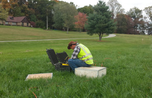
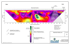
Resistivity measurements are made by introducing an electrical current into the earth between a pair of electrodes and measuring the potential electric current between a second pair of electrodes. By using a long string of electrodes, this allows for a series of resistance values to be determined for the subsurface features, which can then be processed and interpreted into a 2-D cross-section of the subsurface environment.
The great advantage of electrical resistivity imaging, is that it can be used to image geologic features from tens of feet to several hundred feet in depth, and still maintain excellent resolution.
Mundell & Associates uses resistivity methods solve other problems like mapping geologic features such as strata, faults, and karst features; as well as to delineate landfills, locate and quantify amounts of aggregate resources, and others.
Electrical Resistivity Applications
- Geologic Mapping
- Road Slope Stability Analysis
- Natural Resource Development
- Structural Anomaly Locating
- Contaminant Plume Mapping
- Locating and Delineating Fill Materials


