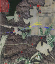
Mundell was contracted to examine an area experiencing subsidence along a section of pipeline crossing a former coal mining portion of central Indiana. To image the underlying soil and bedrock strata beneath the area of subsidence, Mundell collected, several two-dimensional resistivity imaging (2D ERI) profiles. The geophysical data showed that the shallow subsidence along the pipeline was caused by deep, vertical bedrock movement, which was likely the result of a mine collapse. …..Read More »
Portfolio
Mundell & Associates is a small consulting company with large-company credentials and significant experience with some of the most challenging and diverse environmental concerns.
Our project portfolio (which includes case histories, publications, and presentations) covers the world and includes time sensitive investigations as well as long term remediation and monitoring. Clients benefit from a cross disciplinary approach to problem solving and depend on our abilities to communicate complex scientific and engineering principles.
All Case Histories
Geophysical Survey Locates Voids Beneath Concrete Floor
A local construction company discovered voids beneath a concrete building floor after the floor collapsed in several locations. To determine the extent of void development beneath the concrete floor, Mundell personnel completed a geophysical survey using a ground penetrating radar system (GPR), with a 1000-megahertz antenna .The results of the GPR survey indicated several void areas between the bottom of the concrete floor and the underlying fill materials on the order of 0.1 and 0.4 feet in thickness, were linked to leaking sewer pipes nearby……Read More »
Geophysical Survey Locates Buried Conductive Objects at Industrial Landfill Site
A records search and personal interviews at an aluminum industrial facility had reportedly indicated that landfill materials (in particular, carbon cathodes) had been buried in an approximately 53-acre area behind the facility. Mundell personnel completed a GPS controlled EM conductivity survey of the site, and the results indicated several large areas of highly conductive materials, which when excavated, revealed significant accumulations of spent buried carbon material, including several virgin carbon cathodes and anodes, metallic objects, and general construction debris……Read More »
Refraction Microtremor as a Tool to Map Bedrock Fractures
Mundell was retained by an environmental consultant to use the Refraction Microtremor technique (a passive seismic method) to map out the subsurface geology beneath an active industrial site, in an attempt to locate any possible bedrock depressions and fracture zones which could be acting as preferential pathways for soil and groundwater impacts……Read More »
Ground Penetrating Radar Analysis of a Concrete Spillway
Mundell conducted a non-invasive, high-resolution, ground penetrating radar (GPR) survey of a concrete spillway to map the location of potential voids below the concrete after a significant outflow of water was detected from beneath the base of the spillway. The GPR investigation revealed the source of the outflow from beneath the spillway, and verified that the sub-base materials were sound. …..Read More »


