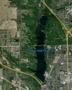
Mundell completed both surface water and groundwater modeling, chemical transport analyses, and field measurements of chloride concentrations and specific conductance to determine the expected level of impact near the site bank and discharge areas……Read More »
Portfolio
Key: Case Histories (![]() ), Publications (
), Publications (![]() ), and Presentations (
), and Presentations (![]() )
)
Quantification of Aggregate Resources Using Geophysics
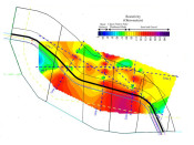
Mundell was contracted to quantify the extent of the sand and gravel reserves located beneath an 18 acre site in central Indiana. The seven resistivity profiles collected across the site indicated not only large volumes of aggregate resources, but allowed for the identification of interbedded clay lenses that would reduce the commercial value of the property from the mining perspective. This information, collected in only two days of field work, allowed the client to evaluate the real commercial value of the property……Read More »
Agricultural SPCC Compliance
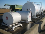
Mundell was asked to assist the members of Indiana Farm Bureau (IFB) in becoming compliant with the United States Environmental Protection Agency (U.S. EPA) Spill Prevention, Control and Countermeasure Plans (SPCC) 3 months prior to the compliance deadline. Our personnel successfully developed and implemented a SPCC Program with the IFB, providing reduced cost SPCC Plans for farmers across Indiana. …..Read More »
Use of Geophysical Surveys for Archaeological Excavation Planning
Mundell used multiple geophysical methods to evaluate a site of suspected Anasazi ruins prior to an archaeological survey. The use of multiple geophysical techniques allowed for the cross correlation of anomalous areas, enhancing the likelihood of finding features of significance, which included a pueblo with connecting rooms, several deep storage pits, and three burials……Read More »
Conductivity Mapping to Locate a Sand and Gravel Aquifer
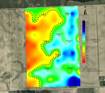
Mundell performed an EM-34 conductivity survey over a 66 acre site to confirm the result of 8 preliminary test borings for an industrial water well. The test borings indicated very little sand and gravel resources were present. After performing the survey and analyzing the results, Mundell’s geophysical department showed the borings were just advanced in poor locations and abundant sand and gravel were indeed present beneath the site……Read More »
- « Previous Page
- 1
- …
- 24
- 25
- 26
- 27
- 28
- …
- 62
- Next Page »


