Mundell was retained by a major law firm specializing in environmental law, to provide expert witness testimony in various legal proceedings relating to a release of petroleum at a major bulk storage facility in the Midwest. Mundell reviewed the groundwater model and the resulting conclusions, finding significant flaws in the construction of the model and the interpretation of the actual groundwater flow conditions. Mundell created various visual aids and models to effectively communicate the relatively complex hydrogeologic concepts to people with little to no geologic background including the litigants, judges, and potential jurors in the case. …..Read More »
Portfolio
Key: Case Histories (![]() ), Publications (
), Publications (![]() ), and Presentations (
), and Presentations (![]() )
)
Utility Mapping at an Active Industrial Facility
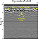
Mundell mapped out subfloor utilities and clear over forty (40) proposed soil boring locations at an active automotive production plant in Indianapolis, Indiana, as part of an ongoing environmental sampling program. Mundell selected ground penetrating radar (GPR) mapping to locate utilities across the site. This technique allowed for worry-free drilling, and also increased production, as many boring were moved to areas not containing reinforced concrete. …..Read More »
Site Assessment at a Former Gasoline Station
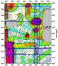
Mundell used EM-61 metal detection in conjunction with localized ground penetrating radar to characterize metal objects beneath a former gas station site. In the end, a single, 3,000 gallon UST was located and determined to be the source of significant soil and groundwater impacts across the site. The use of geophysics on this project was crucial to its successful completion……Read More »
Subsidence Study Using Geophysics
Mundell was contracted to examine an area experiencing subsidence in the backyard of a local residence, which was located near a quarry. The results of the ground-penetrating radar (GPR) survey and 2D resistivity profiles suggested that the subsidence was most likely caused by deep, vertical soil movement which may have been the result of settlement of the unconsolidated soils or soil loss into the underlying bedrock due to quarry activities. …..Read More »
Pipeline Subsidence Study Using Geophysics
Mundell was contracted to examine an area experiencing subsidence along a section of pipeline crossing a former coal mining portion of central Indiana. To image the underlying soil and bedrock strata beneath the area of subsidence, Mundell collected, several two-dimensional resistivity imaging (2D ERI) profiles. The geophysical data showed that the shallow subsidence along the pipeline was caused by deep, vertical bedrock movement, which was likely the result of a mine collapse. …..Read More »
- « Previous Page
- 1
- …
- 18
- 19
- 20
- 21
- 22
- …
- 62
- Next Page »


