Mundell used multiple geophysical methods to evaluate a site of suspected Anasazi ruins prior to an archaeological survey. The use of multiple geophysical techniques allowed for the cross correlation of anomalous areas, enhancing the likelihood of finding features of significance, which included a pueblo with connecting rooms, several deep storage pits, and three burials……Read More »
Portfolio
(Case Histories)
Key: Case Histories (![]() ), Publications (
), Publications (![]() ), and Presentations (
), and Presentations (![]() )
)
Conductivity Mapping to Locate a Sand and Gravel Aquifer
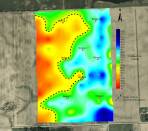
Mundell performed an EM-34 conductivity survey over a 66 acre site to confirm the result of 8 preliminary test borings for an industrial water well. The test borings indicated very little sand and gravel resources were present. After performing the survey and analyzing the results, Mundell’s geophysical department showed the borings were just advanced in poor locations and abundant sand and gravel were indeed present beneath the site……Read More »
Natural Attenuation Prediction Enables Site Closure at Significant Cost Savings
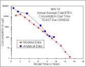
Mundell developed an innovative corrective action plan that predicted monitored natural attenuation would clean the site of a former Department of Transportation (DOT) maintenance facility. IDEM awarded the site the first closure in the State of Indiana using its new RISC guidelines and for this work, Mundell and the City of Indianapolis were also awarded the 1999 A.I.Levorsen Memorial Award by the American Association of Petroleum Geologists, its top environmental prize presented annually for work that, in the opinion of the AAPG, advances the state-of-the-art in the environmental field……Read More »
Polynuclear Aromatic Hydrocarbon Distribution – Superfund Site
Mundell personnel were hired by the Koppers Company as expert witnesses to investigate data gaps, determine chemical source contributions as well as develop life-cycle remedial cost estimates, and testify in the trial proceedings for a lawsuit involving insurance coverage for impacted wood treatment sites. Mundell developed a three-dimensional model of the distribution of various organic chemicals across the site and using the Earth Vision software estimated the mass of site-specific contaminants of concern (COCs) that remained in the soil and groundwater. Ultimately, the analysis was used to support source contribution analysis, and assign liability for the costs of cleanup……Read More »
Hydrogeologic Analysis – Potential Impacts to Town’s Residential Wells
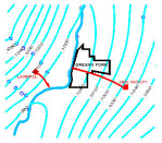
Mundell performed an evaluation of the geologic setting of the town of Greens Fork, IN to provide a preliminary estimate of the potential contaminant release trajectories from two facilities of interest: a landfill and a veal processing plant. Mundell then constructed an estimated groundwater surface (potentiometric) map within the upper aquifer system of Greens Fork……Read More »
- « Previous Page
- 1
- …
- 14
- 15
- 16
- 17
- 18
- …
- 25
- Next Page »


