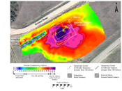
As part of the pre-sale, due diligence environmental site assessments conducted over three petroleum production facilities, Mundell performed an EM-31 terrain conductivity survey across a total of 22 acres of rough terrain to delineate the lateral extent of any salt water impacts that may be present beneath three (3) sites, due to faulty tanks, piping, or engineering controls. Based on the electrical conductivity map, Mundell was able to approximate the acreage of impacts which would need to be remediated prior to the sale of the properties……Read More »
Geophysics Portfolio
(Case Histories)
Key: Case Histories (![]() ), Publications (
), Publications (![]() ), and Presentations (
), and Presentations (![]() )
)
Utility Mapping at an Active Industrial Facility
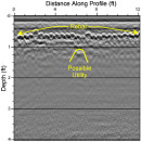
Mundell mapped out subfloor utilities and clear over forty (40) proposed soil boring locations at an active automotive production plant in Indianapolis, Indiana, as part of an ongoing environmental sampling program. Mundell selected ground penetrating radar (GPR) mapping to locate utilities across the site. This technique allowed for worry-free drilling, and also increased production, as many boring were moved to areas not containing reinforced concrete. …..Read More »
Subsidence Study Using Geophysics
Mundell was contracted to examine an area experiencing subsidence in the backyard of a local residence, which was located near a quarry. The results of the ground-penetrating radar (GPR) survey and 2D resistivity profiles suggested that the subsidence was most likely caused by deep, vertical soil movement which may have been the result of settlement of the unconsolidated soils or soil loss into the underlying bedrock due to quarry activities. …..Read More »
Pipeline Subsidence Study Using Geophysics
Mundell was contracted to examine an area experiencing subsidence along a section of pipeline crossing a former coal mining portion of central Indiana. To image the underlying soil and bedrock strata beneath the area of subsidence, Mundell collected, several two-dimensional resistivity imaging (2D ERI) profiles. The geophysical data showed that the shallow subsidence along the pipeline was caused by deep, vertical bedrock movement, which was likely the result of a mine collapse. …..Read More »
Geophysical Survey Locates Voids Beneath Concrete Floor
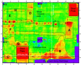
A local construction company discovered voids beneath a concrete building floor after the floor collapsed in several locations. To determine the extent of void development beneath the concrete floor, Mundell personnel completed a geophysical survey using a ground penetrating radar system (GPR), with a 1000-megahertz antenna .The results of the GPR survey indicated several void areas between the bottom of the concrete floor and the underlying fill materials on the order of 0.1 and 0.4 feet in thickness, were linked to leaking sewer pipes nearby……Read More »
- « Previous Page
- 1
- 2
- 3
- 4
- 5
- 6
- …
- 10
- Next Page »


