

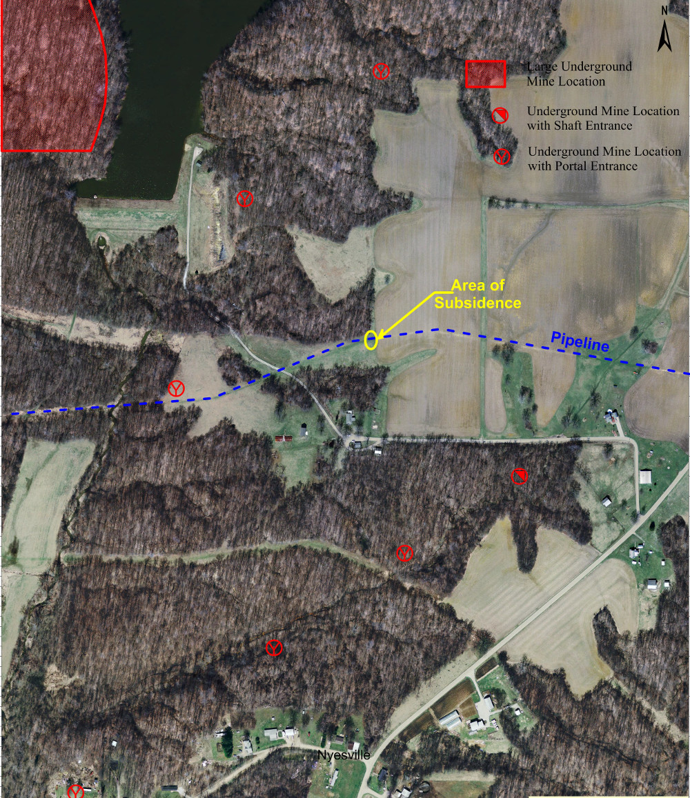
Challenge
Mundell was contracted to examine an area experiencing subsidence along a section of pipeline crossing a former coal mining portion of central Indiana.
Action
To image the underlying soil and bedrock strata beneath the area of subsidence, Mundell collected, several two-dimensional resistivity imaging (2D ERI) profiles.
Results
The resistivity profiles indicated that the bedrock surface was undulating and weathered, and the data collected across this feature clearly indicates that a pit-like feature was developing into the bedrock, which appeared to have collapsed approximately 10-15 feet. Thus, geophysical data showed that the shallow subsidence along the pipeline was caused by deep, vertical soil movement, which was likely the result of a mine collapse.
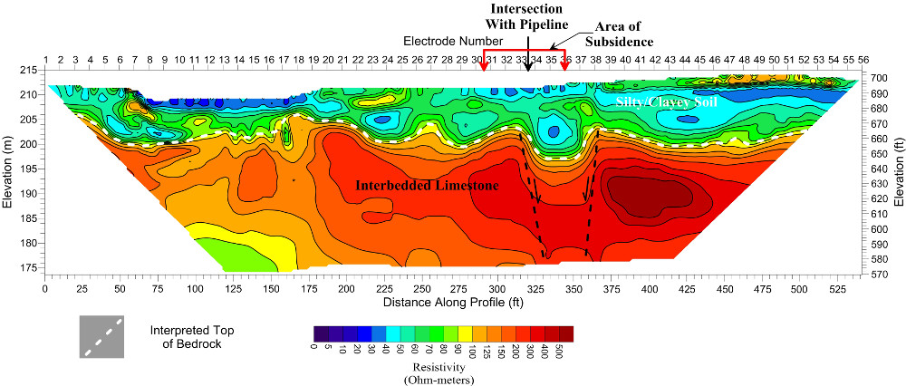
2D resistivity profile detailing the soil/bedrock interface, and showing the downward movement of the limestone bedrock cap located above a historical coal mine.