Challenge
The location of a former chemical manufacturing facility was going to be the home of a new building addition. The 3-acre site was operated from the 1940’s to the mid 1970’s when all previous structures had been razed, and the area landscaped and paved for parking. Although soil borings prior to construction indicated natural sand and gravels were present within the proposed building footprint, the client desired an additional investigation be performed to determine the presence of any environmentally impacted structures from the former operations, and to help guide the excavation activities.
Action
To accomplish the client’s objectives, Mundell personnel completed a multi-faceted geophysical survey using electromagnetic and 2-D electrical resistivity imaging to locate and characterize concealed metallic objects such as underground storage tanks, process piping and utilities, as well as to map variations in the possible fill materials present from the former operation.
Results
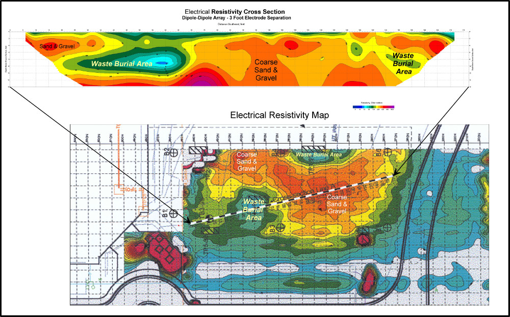
The results indicated several areas of metallic anomalies and potential unknown piping systems that warranted further investigation (see above figure). Mundell used these results to locate test pits for sampling and observation prior to building footprint excavation. Additional 2-D resistivity imaging (see figure below) also indicated a deeper volume of potential former wastes (blue/green area) that would require landfill disposal and handling care during the construction activities. Mundell provided cost estimates for materials handling to the client for project planning purposes, as well as a detailed health and safety plan for managing all wastes during construction. Final estimated quantities were within 5 % of those determined from the geophysical survey.


