Challenge
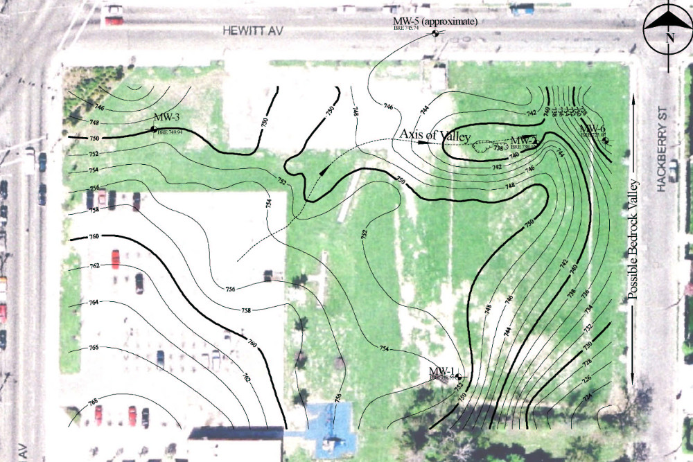
In conjunction with ongoing investigation and remediation activities, Mundell was retained to complete a geophysical survey at a former bus depot in a major midwestern city. The facility has been the site of ineffective remedial activities associated with the release of petroleum hydrocarbons, mainly gasoline and diesel fuels. Because it has been inferred that bedrock topography had influenced contaminant migration, the primary goal of this survey was to fully characterize the top of the bedrock surface to determine product locations.
Action
A seismic refraction survey was chosen as the most appropriate method for mapping the bedrock surface. The seismic refraction data were processed to produce a series of two-dimensional cross sections across the Site (see inset above).
Results
A detailed bedrock topography contour map (see inset below) revealed the release pathway for free product to move and accumulate in the northwest corner of the site, as well as the likely off-site pathway. This information allowed for an effective product recovery system design to improve the rate of cleanup and ultimately to reach an approved site closure.


