Challenge
Mundell was contracted to examine an area experiencing subsidence in the backyard of a local residence, which was present near a quarry.
Action
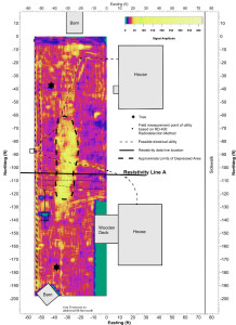
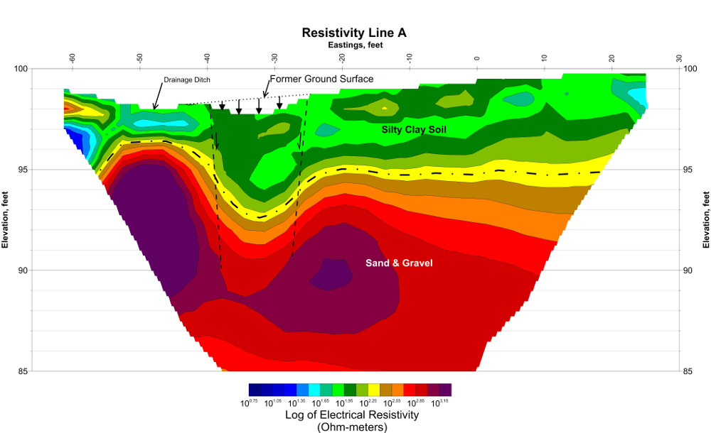
Mundell completed a preliminary ground-penetrating radar (GPR) survey of the area to determine the extent of subsidence (see figure). After the subsidence area had been mapped, several two-dimensional resistivity imaging (2DRI) profiles were completed to image the underlying soil and bedrock strata.
Results
The GPR survey indicated that an area approximately 65 by 15 feet is experiencing subsidence. The resistivity data collected across this feature clearly indicates that a pit-like feature was developing. Despite this, there did not appear to be a shallow soil settlement or soil loss mechanism to explain the subsidence, and based on that, it was thus concluded that the subsidence is most likely caused by deep, vertical soil movement which may be the result of settlement of the unconsolidated soils or soil loss into the underlying bedrock.


